
Search Jefferson County Streets
A careful street-by-street search begins with one exact location, not a name list. Use the Jefferson County Assessor search for the property address or road name, then save the parcel ID and physical address. Open that parcel in the county map, inspect the street and adjoining parcel lines, and treat the owner label as a tax-record association. The parcel identifier gives a steadier bridge than a loose road-name match when a postal city or address format differs.
Next, search the present owner as grantee in the Recorder index and follow the deed's legal description before moving backward. A voter question follows a different route: ask the County Clerk about the paid voter-list request or controlled precinct-register inspection. For older household clues, the library and historical sources may help, but no verified local criss-cross run should be assumed. Each stop has a different purpose.
- Normalize the street number, road name, suffix, and postal locality in the Assessor search.
- Record the parcel ID, situs address, owner label, and any separate tax mailing address.
- Use the Property Viewer to check the parcel location, adjacent lots, roads, and district layers.
- Follow the legal description through the Recorder's grantor and grantee index.
- Use Clerk voter procedures or historical library sources only for the narrower question each record can answer.
Jefferson County Street Search Fields
The Assessor's Devnet portal is the strongest local starting point for a street directory because it separates the physical location from the address used for tax correspondence. Owner names can be useful leads, though a legal owner is not automatically the person at the property. Road-name search is useful for a broad street start. Advanced physical and mailing criteria can narrow results, but the two kinds of address must not be merged.
| Assessor field | Entry type | Use in a street search | Important limit |
|---|---|---|---|
| Owner | Name text | Finds a tax-roll owner or entity name. | Does not establish present occupancy. |
| Parcel ID | Identifier text | Connects property, map, and later records. | Confirm punctuation practice on the live portal. |
| Property address | Address or autocomplete | Searches the physical or situs location. | Use the actual parcel location. |
| Road name | Road text | Offers a broad street-level starting point. | Try suffix and abbreviation variants. |
| Physical criteria | Advanced fields | Filters the parcel location. | Separate from mail routing. |
| Mailing criteria | Advanced fields, ZIP where exposed | Finds tax correspondence addresses. | Not evidence of an occupant. |
County GIS staff also provide public counter computers, and the county says tax rolls and data files can be purchased. That can be a useful fallback when a web query fails or when a reproducible map is needed. Calling the specific Assessor or GIS desk before a visit is more reliable than assuming a general county office holds the record.
Jefferson County Street Map Layers
The no-login Jefferson County Property Viewer accepts an address, city, or parcel ID. It can zoom to a suggestion, show a parcel popup, and add a marker. Its documented tools include Draw, Measure, Select, Print, Coordinate Conversion, Basemap Gallery, Bookmark, Add Data, and PLSS Query. A Parcel ID entered there should omit dots, dashes, and spaces.
Layers provide a civic picture of a street: aerial imagery, parcel boundaries, roads, subdivision lot text, contours, floodplain, ownership data, taxing districts, precincts, townships, and political districts. They can explain why adjacent addresses fall in different fire, ambulance, school, municipal, or road districts. They do not create a resident roster. The county labels the map an assessment and taxing tool, not a boundary survey.
Note: The county's 2026 Property Viewer guide says an F5 refresh can clear a cache or interaction problem.
Jefferson County Street Directory Records
These records are keyed to an address or parcel in different ways. A property roll can identify an owner and tax mailing address, a map can identify the lot, and a deed can identify legal parties and the instrument location. Permits and voter material are also limited-role evidence. None of these sources, alone or together, becomes a complete occupant list.
| Address-keyed source | Custodian | What it can show | Access route |
|---|---|---|---|
| Parcel and tax record | Assessor / Collector | Parcel, owner label, situs, mailing address, tax context | Devnet and county tax search |
| Parcel map | GIS | Lot lines, roads, layers, taxing and political context | Property Viewer or public counter computers |
| Recorded instrument | Recorder of Deeds | Grantor, grantee, legal description, date, instrument location | Tapestry, COTT route, counter, copies |
| Permit or code record | Code Enforcement | Site address, applicant, owner or contractor role, project dates | Citizen Portal, office contact, request |
| Voter record | County Clerk / Election Authority | Name, address, and precinct under documented rules | Paid list request or secured register inspection |
The strongest chain uses the parcel ID and legal description, then dates each result. If the purpose shifts from a whole road to confirming one individual record, use the distinct workflow on the Jefferson County resident lookup page rather than treating a street query as person-level proof.
Jefferson County Situs Addresses
A situs address is the physical location of a parcel or improvement. It helps place a house or lot along a road. A mailing address is where the county sends notices, and it may be elsewhere in Jefferson County, in another city, or outside the county. The Assessor provides separate advanced criteria precisely because the two fields can differ.
Use the physical address to locate the parcel. Preserve the mailing address as a correspondence detail, not a resident claim. An owner name is a legal or tax-roll connection. When a parcel has been subdivided, renamed, renumbered, or absorbed into a municipality, the parcel ID, plat, and legal description are more durable links than the modern street number.
Jefferson County Deed Chain
The Fidlar/Tapestry land-search entry is the county's current index route from April 1, 1985 forward. Search the owner as a grantee, identify the acquisition instrument, and then search that prior grantee as a grantor. Check the legal description on each transfer. Deeds of trust, releases, easements, restrictions, and plats can relate to the parcel without being an ownership transfer.
The Recorder's current deed-index entry is shown below as the source for the street-directory record route.
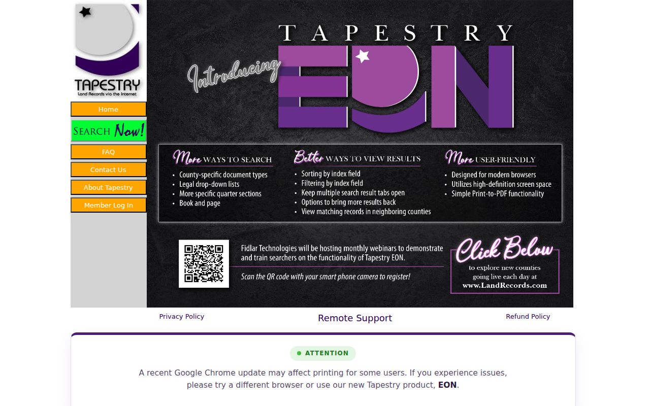
The image points to the current search route, not proof that a named person occupies a particular address. The older COTT/RecordHub path is listed back to 1819 on Recorder Quick Links, while the Recorder FAQ says 1817. Preserve that official 1817/1819 discrepancy and confirm the oldest available book or image with the Recorder.
Recording rules also state that a street address is not a legal description. Lot and block with plat-book and page, metes and bounds, or quarter-section, township, and range language identifies the real estate. That is why legal-description matching should lead any older street research.
Jefferson County Permit Addresses
For unincorporated county work, Code Enforcement handles building, permit, inspection, contractor-license, and code routes. Its Citizen Portal requires registration. A permit can associate a site with an owner, contractor, or applicant and a project date. It does not prove that each named person lived there.
The county residential checklist requires 9-1-1 address verification for new construction and directs an applicant to use the parcel number from a tax receipt or Assessor GIS. That is useful when a new address needs confirmation. No public address-history archive for the current 9-1-1 office was located, so a historical numbering question should go to the relevant municipality, plat, local newspaper, or county archive.
Jefferson County Street Voter Access
Voter material is not a street-search export. The County Clerk and Election Authority handles voter routes. Missouri's public-record rules allow limited voter information, while the local delivered-list description gives full voter name, address, and precinct and excludes birth date, phone, party, and Social Security information. A full county list costs $50, a partial list costs $25, and a county-provided jump drive costs $6.
A completed request form can be sent by email or delivered in person, with up to five business days stated by the county. Precinct registers may be inspected at reasonable times and can be arranged by street address, but they are secured records rather than an open online map. The state lookup requires exact name, date of birth, last four digits of Social Security number, and county, so it is not the right tool for a street-wide question.
Note: Protected-address rules and Missouri Safe at Home procedures mean a missing or substitute address cannot establish that a person is absent.
Jefferson County Street History
No reviewed official source documents a countywide street renumbering or annexation chronology. That is a real research gap, not permission to invent a conversion. Verify an old street number through the appropriate municipality, 9-1-1 process, historical plat, post-office material, county GIS archive, or local newspaper. USPS labels and municipal boundaries may also change independently.
For early Jefferson County records, geography matters. The county was organized in 1818, its first court sat in 1819, and the county seat moved from Herculaneum to Hillsboro in the 1830s. The State Historical Society finding aid for 1818–1826 papers is a useful route when an older place label differs from a later filing location. It does not turn an early county-seat reference into a residence.
For an older De Soto address, the Library of Congress five-sheet May 1893 Sanborn map can help place a building footprint, road, or block in its period setting. Pair that map with the legal description, plat, newspaper date, and census geography. The map supplies built-environment context, not a list of people who occupied the property.
Jefferson County Street Terms
Street records use several terms that look similar but do different work. Keeping the terms separate helps avoid a false link between an owner, a mailing destination, and an occupant.
- Parcel
- A defined taxable piece of land or property with an identifying number used across county systems.
- Situs address
- The physical address or location of the parcel, as distinct from where tax correspondence is mailed.
- Plat
- A recorded map showing lots, blocks, roads, or subdivisions; it can help connect a legal description to a street.
- Criss-cross directory
- An address-arranged directory that can offer a past address clue when a verified local volume is available.
Jefferson County Street Directory Limits
A street directory cannot reveal a complete household. The address chain does not provide a public list of guests, utility customers, delivery recipients, or every household member. Driver-license address information is restricted under federal law. A permit may identify an applicant or contractor, a deed names legal parties, and a voter record identifies a registered voter under its rules. Each is narrower than current occupancy.
Use dated records for family history, estate work, property questions, reconnection, or civic research, then confirm important details with the office that holds the source record. Respect protected addresses and record-use limits.
Lawful use. Jefferson County address records support personal, lawful research only. Do not use them to stalk, harass, intimidate, or harm anyone.